Understanding the site’s features and its setting

Goal: Identify the site’s features and its context

    p1. One of the first things to consider before designing a development is to look beyond the red line of the application site. This is the site context. To do this you should undertake a contextual analysis, which will then be submitted to support your pre-application enquiry or planning application.

    p2. A contextual analysis identifies the context within which the application site is set. This should consider the structure and history of the settlement and landscape in which it is located or relates to, the character of the landscape, biodiversity, the streets and spaces and the built form (all these elements constitute local character). The level of detail in the analysis should be proportionate to the scale and complexity of the development proposal and the sensitivity of the area.

    p3. Each site feature identified provides an opportunity to shape your design, even where they may initially appear to limit what you are able to achieve. Imaginative solutions to incorporate off-site and on-site features can give developments a unique character and form the basis of your design rationale. You should identify and take account of off-site and on-site features at the outset of the design process as there is rarely opportunity to successfully retrofit a design at a later stage. There should be a clear drawing trail showing how the design of the development has evolved. If the site identifies important habitat connectivity features (watercourses, tree lines, hedgerows, other swathes of linking habitat), this should influence any early framework design.


Developing a design rationale

Goal: Use the site’s features and context to shape your design

    p4. A design rationale is an explanation of the reasons behind the design decisions you make. Developing a design rationale is important; it is the basis for discovering workable and imaginative design solutions and provides justification for them.

    p5. When developing a design rationale, think about whether there is something from the site and its setting that can enhance place-identity. Landform, habitats, archaeological features, registered parks and gardens, etc., all provide elements that design can be based upon and inspired by. Focus your design rationale on creating a sense of place.

    p6. When thinking of creating character areas within a development, move away from notional character areas. Instead, use existing site features to inform where different character areas may naturally occur. Create a narrative around place-identity and the spaces defined by the features of the site (for example, there may be a brook or a village green on a site that has historical value which you may want to draw upon). Do not tightly define character area boundaries but make sure to have a gradual transition between them. Focus on the character of the streets/area as a way of creating attractive and defined spaces.

    p7. Developing a design rationale is a preliminary step within the design process. Design rationales are influenced by the overall design process, they develop and adjust based on the research and detail provided by further steps. They should be flexible and take consideration of emerging issues and technical detail; they should always aim for high quality and sustainable design outcomes and demonstrate this through supporting work and documentation.


Steps

Inform your design:

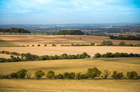
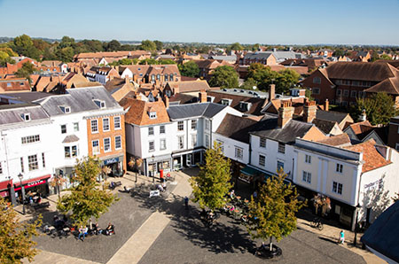
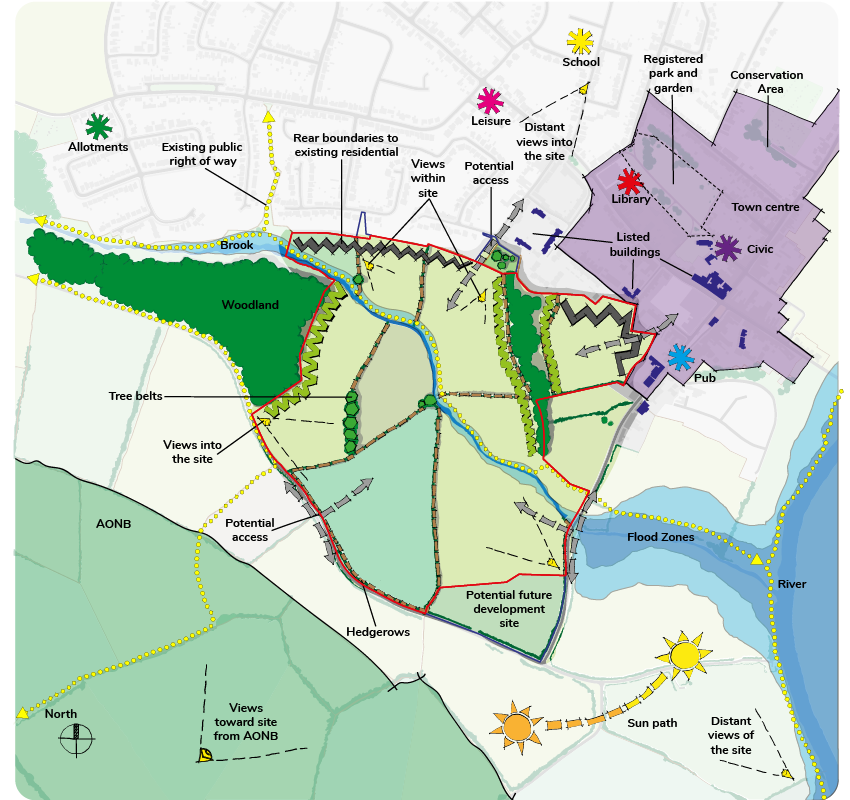
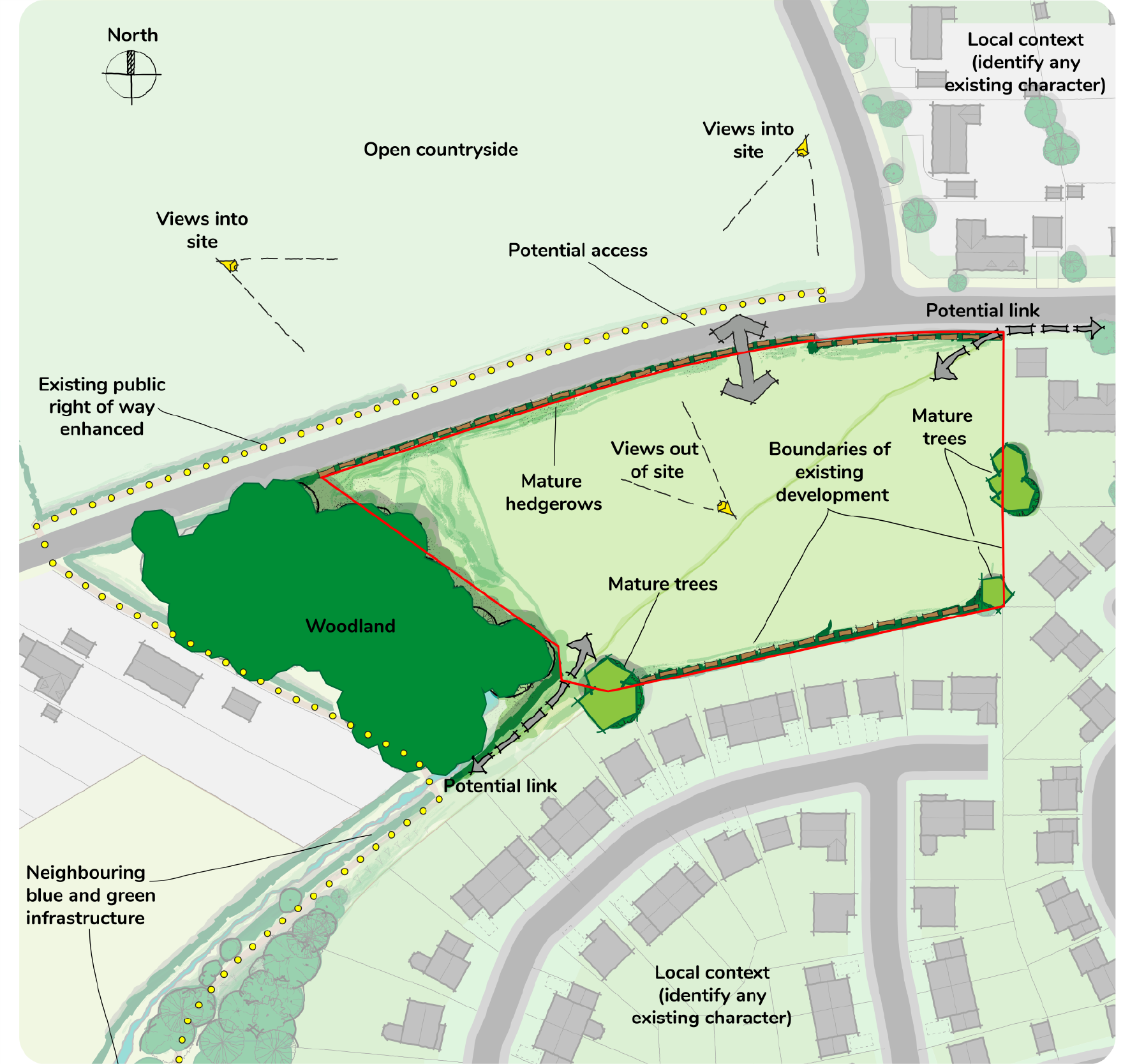
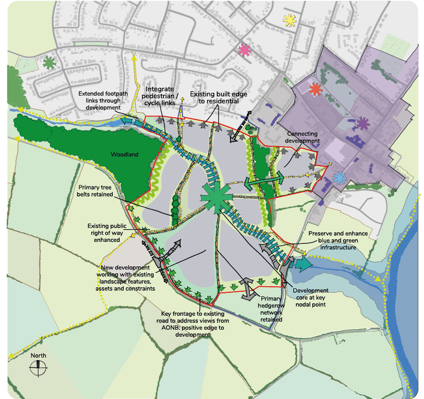
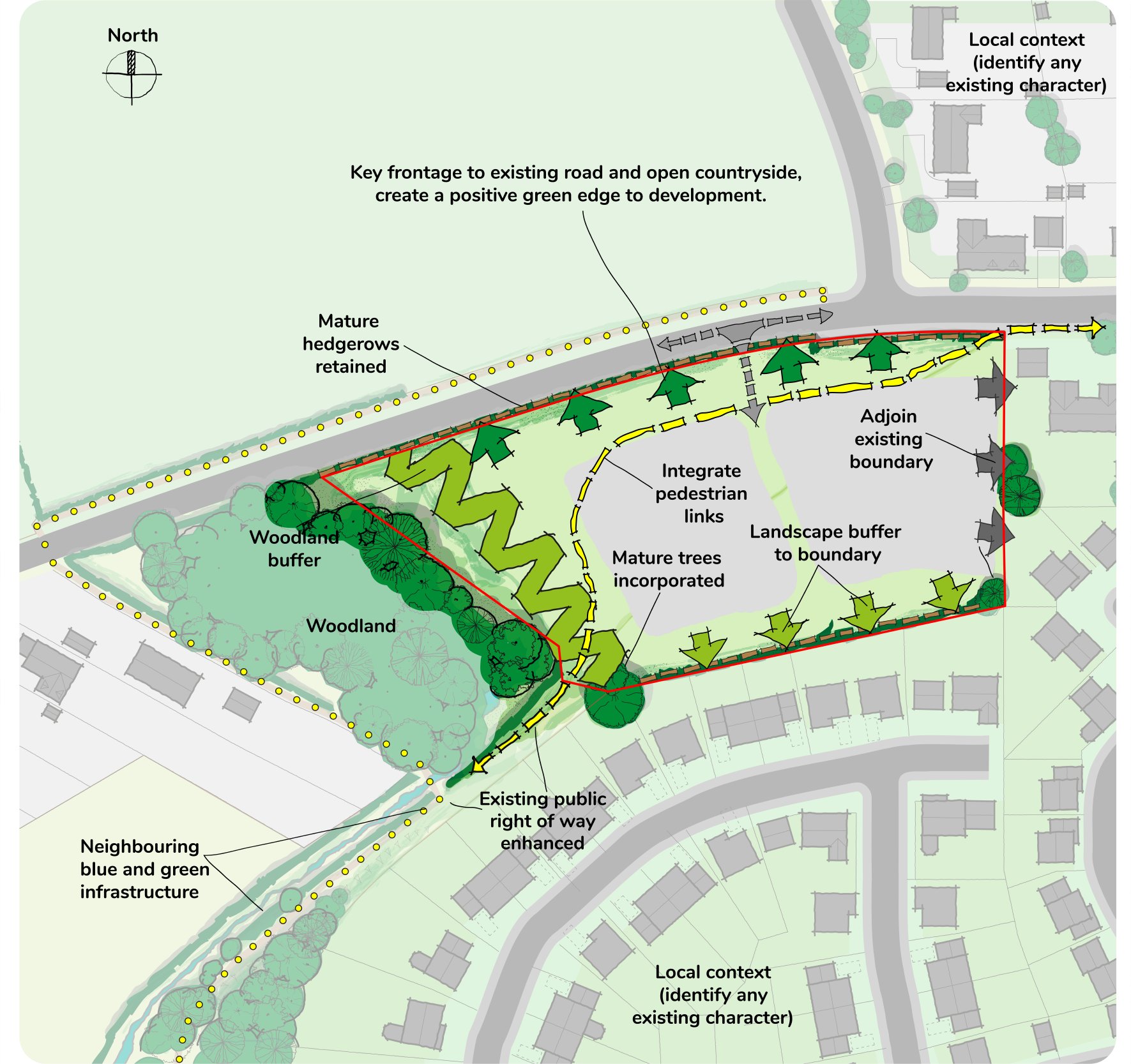
Prepare a contextual analysis that identifies the local character of the application site and its wider context. This should consider the structure and history of the settlement within which the site is located, or which it relates to, as well as the character of the landscape, biodiversity, streets, spaces and the built form.

Prepare technical studies including (but not limited to) surveys on landform, watercourses, trees, habitats, species, etc.

Agree the scope of a landscape and visual impact assessment/appraisal with the local authority. The assessment should be proportional to the scale of the development and the sensitivity of the site and its setting.

Communicate your design:

An opportunities and constraints plan with a clear key;

A concept plan with a clear key;

A Framework plan.

Support your design:

Building for a Healthy Life (2020)

South Oxfordshire District Council’s Developer’s Guidance on Air Quality

Vale of White Horse District Council’s Developer’s Guidance on Air Quality

South Oxfordshire Conservation Area Appraisals

Vale of White Horse Conservation Area Appraisals

Didcot Garden Town Masterplan (Chapter 9 A masterplan for Didcot Garden Town, 2017)

South Oxfordshire District Council Landscape Character Assessment (2017)

Vale of White Horse Landscape Character Assessment (2017)

Chilterns Building Design Guide


Photo
View from Uffington towards Faringdon
Photo
View from Thames river towards Culham cut
Photo
Abingdon town centre market square
Photo
Thame town centre market square

A contextual analysis including an opportunities and constraints plan (which will inform your design rationale) of the wider and immediate site context has been prepared. It identifies the following both within the site and beyond the site boundary:

    • 1.0       Existing networks of natural features, including watercourses, trees, woodland, hedgerows, green spaces, field patterns, habitats and public rights of way (footpaths, bridleways, etc.);
    • 1.1       The landscape character and topography highlighting visually prominent areas;
    • 1.2       Attractive and/or sensitive views and skyline (both of and from built and natural features) into, out of and within the site;
    • 1.3       Buildings and structures of historical importance including listed buildings, associated setting and historic views, historic landscape pattern and features (historic landscape character), conservation areas, historic parks and gardens and archaeological remains;
    • 1.4       Any statutory designations such as National Nature Reserves, AONBs, Green Belt, and Sites of Special Scientific Interest (SSSIs) amongst others, and non-statutory designations such as Ancient Woodland, Dark Skies, valued landscapes and Registered Battlefields, amongst others;
    • 1.5       Potential barriers to development such as railway lines, major roads, utilities, pipelines, noise, pollution, land contamination, flooding, etc., and any resulting easements including those specified in the Local Plan(s);
    • 1.6       The settlement structure of the site and surrounding area: this includes studying the historical development of the settlement, its townscape; structure and hierarchy of streets, spaces, facilities, existing connections (including public rights of way and cycle routes), gateways, nodes, density, plot and block sizes. Figure ground diagrams can help explain a settlement structure;
    • 1.7       The land uses adjacent to the site and how these will impact on the design/treatment of the edges of the development - identify how each edge of the development site will address the adjacent uses;
    • 1.8     The streets and public spaces surrounding the site, the enclosure of streets and public open spaces, the layout and form of spaces and the public and private interface;
    • 1.9     The built character: the scale, form and massing of the built environment, treatment of building frontages and boundaries, building types and materials. This should all be included in a Character Study.

Note: All design principles are applicable to all scales of development unless otherwise specified; *minor applications, **major applications